Easy Ways to Remember Latitude and Longitude and Their Order
longitude and latitude. Here's a easy way to remember them.
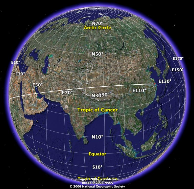
Longitude is “long”. It passes north pole and south pole. It's vertical lines.
Latitude is horizontal lines. Think of it as the horizontal lines in “ladder”.

by convention, the order is {latitude, longitude}. This is like {y, x} if written in math convention. So, just remember it's reverse from math.
Meridian (geography) = a great circle passing north pole and south pole. It's also called “line of longitude”.
Thus, there are many meridians. The one that passes Greenwich is called prime meridian. (Greenwich is inside London) Meridians are perpendicular to equator.
A “knot” means 1.852 km per hour. The essence is that it's equal to one minute of latitude. A ship traveling at 1 knot for 1 hour along a meridian would move 1 minute of latitude. If it travels at 60 knots for 1 hour, it would have moved one degree.
the term Knot came historically, when long ago ship speed is measured by dipping a line into the sea and as the ship moves, letting the line unroll from a reel, and measure how long it takes for the ship to pull the line till next knot tied on the line is reached.
Until the mid-19th century vessel speed at sea was measured using a chip log. This consisted of a wooden panel, weighted on one edge to float perpendicular to the water surface, and thus present substantial resistance to moving with respect to the water around it, attached by line to a reel. The chip log was “cast” over the stern of the moving vessel and the line allowed to pay out. Knots placed at a distance of 47 feet 3 inches (14.4018 m) passed through a sailor's fingers, while another sailor used a 30 second sand-glass (28 second sand-glass is the current accepted timing) to time the operation. The knot count would be reported and used in the sailing master's dead reckoning and navigation. This method gives a value for the knot of 20.25 in/s, or 1.85166 km/h. The difference from the modern definition is less than 0.02%.